Understanding the Challenge of Landfill Leachate Migration
Landfill leachate is a persistent environmental-management concern for waste operators, municipal authorities, and environmental engineering firms. Because leachate migration occurs below ground, changes in moisture conditions, rainfall, groundwater levels, landfill materials, and geological structure can affect how electrical and hydrogeological conditions develop over time.
Traditional borehole drilling and periodic sampling remain important verification methods. However, they provide information only at selected locations and time intervals. For large or complex landfill sites, relying solely on periodic investigation can make it difficult to maintain a continuous record of changing subsurface conditions.
A more robust investigation strategy combines periodic geophysical surveys, hydrogeological assessment, boreholes and sampling where required, and online monitoring at locations where continuous observation is needed.
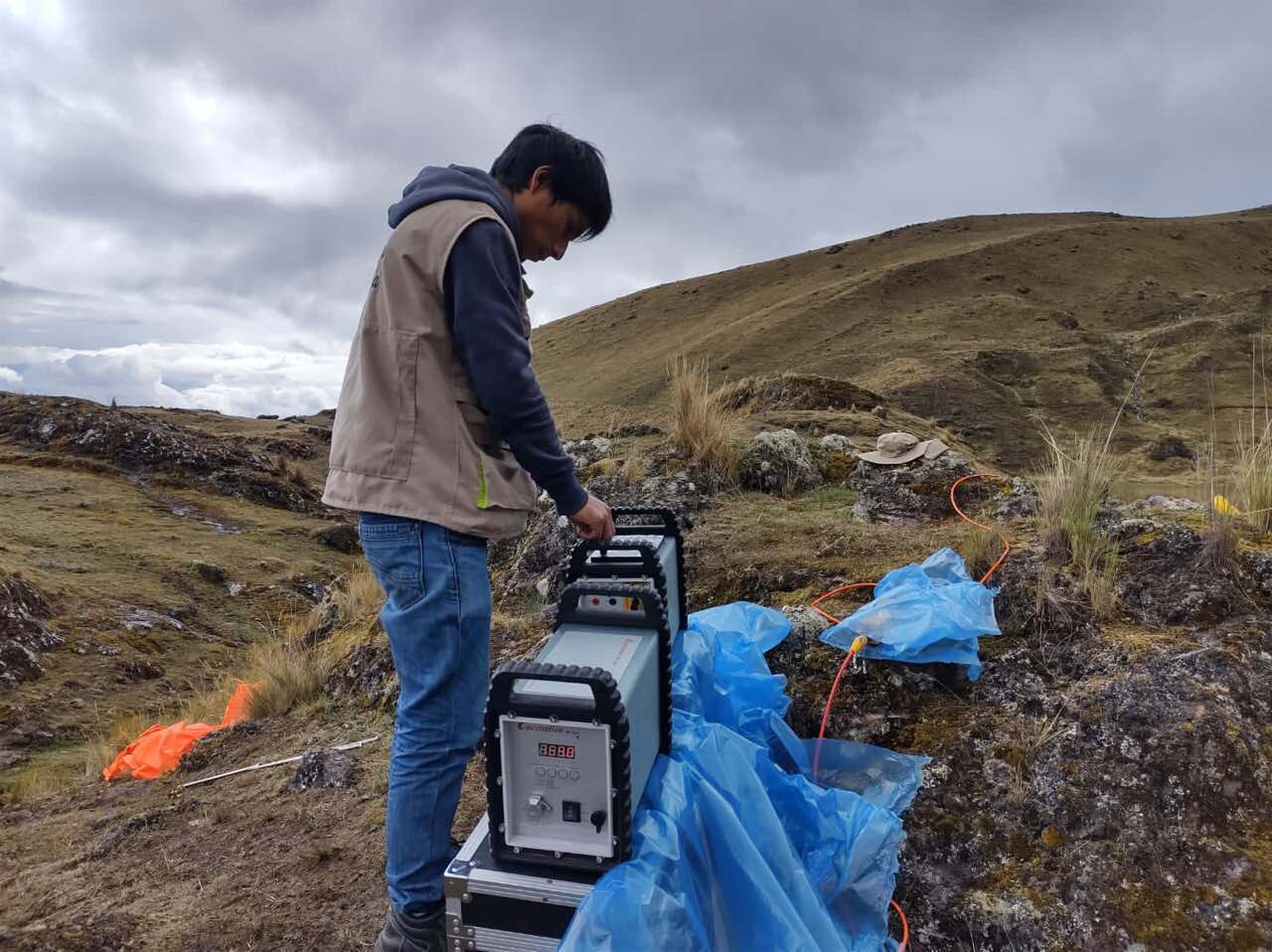
Combining Site Investigation with Continuous Observation
Geomative Co., Ltd. provides geophysical equipment and online-monitoring solutions under its “Geophysics+” concept, combining field hardware, connectivity, and digital data workflows.
For landfill applications, this approach can be divided into two complementary tasks:
-
Site investigation: Electrical and other geophysical methods can help identify subsurface electrical anomalies, landfill boundaries, moisture-related zones, and areas that may require further investigation.
-
Online monitoring: Installed monitoring equipment can provide continuous data on changing conditions and support remote review and alert workflows.
Neither component should be treated as a standalone confirmation of leachate contamination. Geophysical anomalies require interpretation alongside landfill records, geological conditions, borehole data, groundwater samples, and laboratory analysis where appropriate.
DIGspace Geo-3D Platform and the Online Monitoring Workflow
According to Geomative’s latest product information, DIGspace Geo-3D Platform is the company’s current platform name for its digital data-management direction.
The published Geomative Online Monitoring System combines on-site automated monitoring equipment, cloud data transmission, and monitoring-data management tools. It supports real-time online monitoring, data display, inversion and modeling workflows, configurable alert thresholds, and multiple notification methods.
For landfill leachate monitoring, the system can be configured to support continuous observation of electrical and related monitoring data. Through IoT communication and cloud-based data handling, authorized users can remotely review data trends and receive alerts when configured thresholds or abnormal conditions are triggered.
This workflow can reduce the need for routine manual data retrieval, but it does not eliminate the need for site installation, equipment maintenance, data review, and field verification after an alert.
What Real-Time Monitoring Can—and Cannot—Do
Online monitoring can provide several practical benefits for landfill operators:
-
Create a continuous time-series record rather than relying only on isolated inspection results;
-
Support remote review of monitoring data and operating conditions;
-
Provide configurable alerts for readings that meet predefined abnormality criteria;
-
Help operators prioritize where follow-up inspection, sampling, or repair assessment may be needed;
-
Support multi-user and multi-project data collaboration.
However, a monitoring alert is not the same as a confirmed leak, pollutant concentration, or regulatory finding. Changes in electrical response may also be affected by rainfall, groundwater variation, temperature, soil conditions, cable contact, and other site-specific factors. Alert results should therefore trigger engineering review and, when needed, targeted verification using boreholes, samples, and laboratory testing.
Electrical Resistivity Surveys for Landfill Investigation
Electrical resistivity methods can provide spatial information that complements fixed-point monitoring. By measuring subsurface electrical-property variations along survey lines, Electrical Resistivity Tomography (ERT) can help identify zones that warrant further investigation.
Geomative’s GD-10 and GD-20 electrical resistivity systems can be used for relevant electrical survey tasks:
-
GD-10: A single-channel electrical resistivity and induced-polarization system suited to targeted field surveys and flexible survey configurations.
-
GD-20: A multi-channel electrical resistivity and induced-polarization system intended for projects requiring improved field-testing efficiency across larger areas or multiple survey lines.
The GD-20 uses an independent 5/12-channel design. Depending on the survey mode and configuration, it can support up to 10 ERT acquisition channels and up to 12 sounding points. Geomative states that average field-testing efficiency can be 2–3 times that of single-channel equipment under comparable conditions.
Such efficiency gains concern field testing and do not guarantee contamination-detection accuracy, remediation outcomes, or lower total project cost.
A Landfill Investigation Reference Case
Geomative has published a landfill-leachate investigation case in which a combination of spontaneous-potential (SP), charging-potential (CP), and high-density resistivity methods was used to assess a closed domestic-waste landfill where leachate leakage was suspected.
The project workflow included site investigation, geophysical data acquisition, interpretation, and delineation of areas requiring attention. The project interpretation identified several suspected leakage areas and an area of possible bottom-liner damage; the results were assessed in conjunction with site conditions and resistivity-profile interpretation.
This case demonstrates the value of combining multiple geophysical methods for landfill investigation. It should not be interpreted as evidence that one geophysical method alone can conclusively confirm every leachate pathway or pollutant impact.
From Baseline Investigation to Ongoing Monitoring
A practical landfill monitoring program can follow a staged approach:
-
Review existing site information
Gather landfill design records, waste history, hydrogeological information, rainfall data, existing boreholes, and prior sampling results. -
Conduct baseline geophysical investigation
Use appropriate methods, such as ERT and other site-specific geophysical techniques, to identify electrical anomalies and define locations for further assessment. -
Verify priority findings
Use boreholes, groundwater monitoring wells, sampling, laboratory analysis, and engineering inspection to confirm the nature of identified anomalies. -
Deploy online monitoring where justified
Install monitoring equipment and communication infrastructure at selected locations based on engineering requirements and site conditions. -
Review trends and respond to alerts
Use the online platform to review time-series data, investigate abnormal readings, and implement targeted field checks or remediation decisions when necessary.
This staged approach helps connect broad-area investigation with continuous observation and evidence-based follow-up.
A Practical Framework for Landfill Operators
For operators assessing landfill-leachate detection and monitoring options, the key question is not whether a single device can solve every uncertainty. It is whether the proposed workflow links site investigation, monitoring, verification, and response in a practical way.
Geomative’s electrical resistivity systems can provide spatial data for landfill and subsurface investigation, while its online monitoring system can support continuous remote observation and alert workflows. DIGspace Geo-3D Platform can serve as the digital direction for organizing and presenting relevant project data.
Geomative’s website states that its solutions are deployed in more than 40 countries and regions, across 100+ industry applications, and used by more than 1,000 clients worldwide. For landfill operators, the most effective application of this equipment ecosystem is as part of a broader environmental-management program that combines geophysical evidence with hydrogeological, engineering, and laboratory verification.
Geomative Co., Ltd.
https://www.geomative.com/